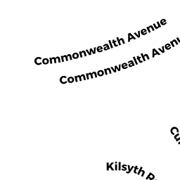
44 KILSYTH RD 3 & P31
Owner Information
SHAMIR BEN
44 KILSYTH RD #3
BROOKLINE, MA 02445


Property Details
44 KILSYTH RD 3 & P31 is classified as a Residential Condominium (Row end).
The primary structure on this property was built in 1910. There is 1,690ft2 of residential/living space within this property. This property is listed as having 7 rooms.
44 KILSYTH RD 3 & P31 is valued at $1,066,300. The land is valued at $0 and the structures are valued at $1,066,300.
The most recent deed for 44 KILSYTH RD 3 & P31 is recorded at the local registrar in Book 25866, Page 47. 44 KILSYTH RD 3 & P31 was last sold on Wednesday, June 25, 2008 for $655,000.
Assessment data from fiscal year 2021.
Flood Data
According to the FEMA National Flood Hazard Layer, this property does not appear to be in a flood zone. It may also be in an area not yet reviewed. Nonetheless, confirm this information prior to taking any action.
To view the flood hazards around this property, create a FEMA "Firmette" Map of the area around 44 KILSYTH RD 3 & P31.
Broadband Internet Providers
| Provider | Type | Bandwidth (mbps) | |
|---|---|---|---|
| Verizon New England Inc. | DSL | 15 | 1 |
| Comcast | Cable | 1000 | 35 |
| RCN | Cable | 500 | 20 |
| Viasat Inc | Satellite | 100 | 3 |
| Starry, Inc. | Fixed Wireless | 200 | 200 |
| GCI Communication Corp. | Satellite | 0 | 0 |
| HughesNet | Satellite | 25 | 3 |
| VSAT Systems, LLC. | Satellite | 2 | 1 |
| Crown Castle Fiber | Fiber | 0 | 0 |
| RCN | Cable | 1000 | 20 |
Broadband service provider data from December 2020.
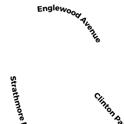
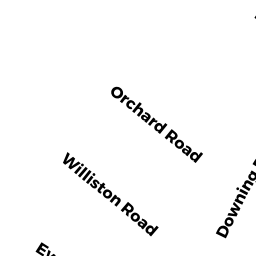
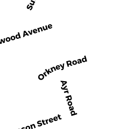
Adjacent Properties
- 31 1/2 ENGLEWOOD AVE 6
Residential Condominium owned by LEE TRS EMMELINE CHIN - 21 ENGLEWOOD AVE 21-4 & P34
Residential Condominium owned by JOEL SHIRLEY & YALE - 25 ENGLEWOOD AVE 25-2 & P7
Residential Condominium owned by WU SHUO CHIEH - 29 ENGLEWOOD AVE 29-5 & P16
Residential Condominium owned by PULESTON KATHRYN - 19 ENGLEWOOD AVE 19-2 P-15
Residential Condominium owned by TSOMIDES DIANE G - 19 ENGLEWOOD AVE 19-3 & P4
Residential Condominium owned by CHUI BARRY - 19 ENGLEWOOD AVE 19-4 & P72
Residential Condominium owned by LOUI CARLOS - 19 ENGLEWOOD AVE 19-5 & P61
Residential Condominium owned by BOYAR RACHEL - 19 ENGLEWOOD AVE 19-6 & P5
Residential Condominium owned by FEENEY MICHAEL J - 19 ENGLEWOOD AVE 19-7 & P2
Residential Condominium owned by ROUKHADZE TOM - 21 ENGLEWOOD AVE 21-1 & P76
Residential Condominium owned by SANTOS PATRICIA & MARIO C BUENO DOS & RUTE - 21 ENGLEWOOD AVE 21-2
Residential Condominium owned by JIN JINGMIN & ERDAN - 21 ENGLEWOOD AVE 21-3 & P62
Residential Condominium owned by ROSKIN MICHAEL & YEVGENIYA - 21 ENGLEWOOD AVE 21-5 24&27
Residential Condominium owned by PRETORIUS TR ABRAHAM M - 21 ENGLEWOOD AVE 21-6 & P17
Residential Condominium owned by ZHENG HUI - 23 ENGLEWOOD AVE 23-1
Residential Condominium owned by DRUCKER MITCHELL - 23 ENGLEWOOD AVE 23-2 & P75
Residential Condominium owned by DAVIDSON IDA - 23 ENGLEWOOD AVE 23-3 & P8
Residential Condominium owned by WEI XIAOHUI - 23 ENGLEWOOD AVE 23-4 & P46
Residential Condominium owned by XING JIANGANG - 23 ENGLEWOOD AVE 23-5 & P9
Residential Condominium owned by RODDY CECILIA - 23 ENGLEWOOD AVE 23-6 & P6
Residential Condominium owned by ANDLER EMILY F - 25 ENGLEWOOD AVE 25-1 & P12
Residential Condominium owned by BERGMAN TRS JON C & JACKIE L - 25 ENGLEWOOD AVE 25-3 & P13
Residential Condominium owned by ZELJKOVIC MIHAJLO - 25 ENGLEWOOD AVE 25-4
Residential Condominium owned by HUANG TSAI HUEY - 25 ENGLEWOOD AVE 25-5 & P11
Residential Condominium owned by TILLEMAN TAMARA RAVEH - 25 ENGLEWOOD AVE 25-6 & P32
Residential Condominium owned by PETROZZINO MARK & CATHERINE - 27 ENGLEWOOD AVE 27-1
Residential Condominium owned by SERU-GARDNER TRS RITA C - 27 ENGLEWOOD AVE 27-2 & P40
Residential Condominium owned by VORONINA TR LYDIA - 27 ENGLEWOOD AVE 27-3
Residential Condominium owned by DONOVAN MARCIA - 27 ENGLEWOOD AVE 27-4 & P41
Residential Condominium owned by TAHBAZ NEGAR - 27 ENGLEWOOD AVE 27-5 & P25
Residential Condominium owned by LEW PATRICIA - 27 ENGLEWOOD AVE 27-6 & P23
Residential Condominium owned by MARTIN HOLLY H - 29 ENGLEWOOD AVE 29-1
Residential Condominium owned by PAIGE JEFFREY M & ESTHER - 29 ENGLEWOOD AVE 29-2 & P37
Residential Condominium owned by GANCHI LEYLA S - 29 ENGLEWOOD AVE 29-3 & P14
Residential Condominium owned by GOIHBERG POLINA & EDUWARD - 29 ENGLEWOOD AVE 29-4 & P45
Residential Condominium owned by WHITE TRS SHEILA - 29 ENGLEWOOD AVE 29-6 & P22
Residential Condominium owned by CHU VINCENT - 31 ENGLEWOOD AVE 31-1 & P67
Residential Condominium owned by ULTAIGH TR NIAMH - 31 ENGLEWOOD AVE 31-2
Residential Condominium owned by HU GUIFEN - 31 ENGLEWOOD AVE 31-3&P74
Residential Condominium owned by MASSE CHRISTOPHE & CECILE - 31 ENGLEWOOD AVE 31-4 & P73
Residential Condominium owned by PINSKY EUGENE - 31 ENGLEWOOD AVE 5
Residential Condominium owned by YUU COLLEEN - 31 ENGLEWOOD AVE 31-6
Residential Condominium owned by KULAPATNA PORNTEP & PHATTEEPHR - 31 1/2 ENGLEWOOD AVE 1 & P3
Residential Condominium owned by CHING HENRY - 31 1/2 ENGLEWOOD AVE 2 & P80
Residential Condominium owned by KURZMAN ABBY - 31 1/2 ENGLEWOOD AVE 3 & P1
Residential Condominium owned by PLATIKANOV STEFAN - 31 1/2 ENGLEWOOD AVE 4 & P82
Residential Condominium owned by TAUBIN ALEXANDER & MAGNITSKAIA T - 31 1/2 ENGLEWOOD AVE 5 & P26
Residential Condominium owned by BRADFORD NANCY R - 31 1/2 ENGLEWOOD AVE 7
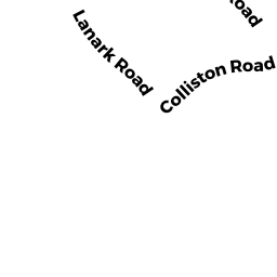
Residential Condominium owned by MILLER, ET AL ANNE H - 1 LANARK RD 1-1 & P54
Residential Condominium owned by TSIEH PETER - 1 LANARK RD 1-2 & P18
Residential Condominium owned by GHAFARI RAMIN - 1 LANARK RD 1-3
Residential Condominium owned by ZIMMERMAN, ET AL MICHAEL - 1 LANARK RD 1-4 & P81
Residential Condominium owned by HEINE WALTER F & VELVIZHI RANGANATHAN - 1 LANARK RD 1-5
Residential Condominium owned by VARNEY GEORGE W - 1 LANARK RD 1-6 & P68
Residential Condominium owned by ROTSIMO ZOYA - 1 LANARK RD 1-7
Residential Condominium owned by NICOLAZZO BARBARA - 7 LANARK RD 7-1
Residential Condominium owned by KERN ROBIN K - 7 LANARK RD 7-2
Residential Condominium owned by ANASTAS TIMOTHY C - 7 LANARK RD 7-3
Residential Condominium owned by CIAVATI, TR DOROTHY V - 7 LANARK RD 7-4 & P65
Residential Condominium owned by SHAUGHNESSY FRANCEEN A & ROSEMARY - 7 LANARK RD 7-5
Residential Condominium owned by YE JINGBO - 7 LANARK RD 7-6 & P-70
Residential Condominium owned by SLOSAR TRS JIRI & HEATHER COLEEN - 19 ENGLEWOOD AVE 19-1 & P77
Residential Condominium owned by SINGH BHAGAT & VANDANA - 48 KILSYTH RD 2 & P35
Residential Condominium owned by NOBLE MICHAEL S - 48 KILSYTH RD 3 & P36
Residential Condominium owned by KAZAKAITIS TR LAIMA - 48 KILSYTH RD 1
Residential Condominium owned by JOE DAVID & NAO